TrailManor Owner's Forum  

Go Back   TrailManor Owner's Forum > TrailManor Camping & Lifestyle > Off Topic
Register FAQ Members List Calendar

Reply
 
Thread Tools Display Modes
Old 08-26-2009, 07:49 PM   #1
TexasCamper
Senior Member
 
TexasCamper's Avatar
 
Join Date: Apr 2009
Location: Texas
Posts: 153
Default Highway Topography Info

I've been casually looking on the internet for maps or a software tool that can show highway topography. Or something that lists out all 6%+ grades. Anybody know of anything like this available???? There's only so much you can assume from a state topography map.

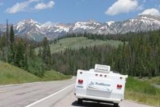
When planning cross-country routes, I'd like to know a little more about where the worst ups & downs are. That way I can adjust my plans for how long to drive those days; and ideally so I can avoid the worst grades and find an alternate route that isn't as bad.

John
__________________
2008 TM3023
TV#1: 2008 Chrysler Town & Country (3.8L Touring w/ tow package, WDH) (*retired 2018*)
TV#2: 2015 Nissan Pathfinder (w/ tow package, WDH)
TV#3: 2018 Ford F150 (w/ tow package, WDH)
TexasCamper is offline   Reply With Quote
Old 08-27-2009, 10:19 AM   #2
Bill
Site Team
 
Bill's Avatar
 
Join Date: Feb 2003
Location: The mountains of Scottsdale, AZ, and the beaches of Maine
Posts: 10,105
Default

Long-distance bicyclists care a lot about this, and have tools such as you ask about. Not being a long-distance bicylist, I'm not familiar with any of them, but a Google search on "elevation profile" brings up a lot of hits.

I know that some GPS receivers can do it, too, but the procedure for doing it in advance (as opposed to after the fact, which I have done) may be clunky. Let me do a bit of reviewing, assuming no one else has a good answer

Bill
__________________
2020 2720QS (aka 2720SL)
2014 Ford F-150 4WD 5.0L
Bill's Tech Stuff album
Bill is offline   Reply With Quote
Old 08-27-2009, 05:19 PM   #3
freein05
Guest
 
Posts: n/a
Default

The mapping software I got last year with my Trailer life directory includes grades. If you go to tools and set the % of grade you want it to high lite. It will put it on the trip map you asked it to calculate on your computer.

The mapping software is not that good. You have to be careful. It will take you over 4X4 roads if you are not careful. I have not figured out a method so it will not take you over 4X4 roads.
  Reply With Quote
Old 08-27-2009, 06:33 PM   #4
rumbleweed
Guest
 
Posts: n/a
Default

Take a look at Topo8 from Delorme. It provides actual elevation detail for your route or any part of it. It is available in full US or eastern and western sections at half price. See attached screen shot showing elevation for highlighted route in Blue Ridge.
Attached Files
File Type: doc Topo 8 Demo.doc (746.5 KB, 33 views)
  Reply With Quote
Old 08-28-2009, 02:57 PM   #5
Joseph
Guest
 
Posts: n/a
Default Mountain Directory West ( or East )

I have a thin book titled Mountain Directory West. It has locations and descriptions of over 400 mountain passes and steep grades in eleven western states. I got it just for grins and to know where the really steep climbs and descents would be, if any, along my route. Since it is a book it does not require a computer or electricity to use and goes well with a cup of coffee in the morning before pulling out.... I did a quick search on the web and it comes up in many bookstores. ( and keep your brakes in good working order
  Reply With Quote
Reply


Currently Active Users Viewing This Thread: 1 (0 members and 1 guests)
 

Posting Rules
You may not post new threads
You may not post replies
You may not post attachments
You may not edit your posts

BB code is On
Smilies are On
[IMG] code is On
HTML code is Off

Forum Jump

Similar Threads
Thread Thread Starter Forum Replies Last Post
2720SL weight info jcjim4 Towing and Hitching 17 04-09-2009 08:57 AM
Info on 2004 3023 mrmurph1 Prospective Owner Questions 2 03-31-2009 03:16 PM
Select Comfort info. Queeniereads General TrailManor Topics 4 04-16-2007 10:07 AM
Need More Signature Info fcatwo Forum Admin | Account Help | Suggestion Box 3 08-17-2005 09:06 AM


All times are GMT -6. The time now is 11:31 AM.


Powered by vBulletin® Version 3.8.11
Copyright ©2000 - 2024, vBulletin Solutions Inc.
Copyright 2022 Trailmanor Owners Page.