This is a trek that may be of interest to some, it isn't city specific because of the length.
1. Get the map and plan carefully! Over all signage is good but

.
Sometimes one sign has you turn and at the same time the other wants you to go straight.
Why this happens is because the Great River Road is actually two routes; one on the east side on the Mississippi and the other on the west side. One on those signs above is taking you across the river. Our suggestion take the eastern side to go south and the western side to go north.
Plan, plan and plan as the roads you take are US hwys, some state roads, and some will be back country county roads. If you use electronic navigation as we do; plan the route on your GPS compatible laptop mapping soft ware. Another source is Goggle maps as it is compatible with some GPS equipment. After making a section of route, we do between CG's, review it closely in Goggle Earth for traps, ie intersections that don't exist or dirt instead of a paved road. Once done upload to your GPS and keep a copy on your laptop should you want to make changes. High lite your route on paper maps for your co-poilet / navigator.
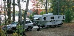
2. Campgrounds are plentiful, often less then 50 miles apart. They run the gambit from fish camps to state parks to ACOE to private. Most are directly on the river.
3. Useful links:
http://experiencemississippiriver.com/
http://www.roadsideamerica.com/
http://corpslakes.usace.army.mil/visitors/
http://www.allstays.com/Campgrounds/
As we think of stuff we will update this


 .
. Linear Mode


